Illustrated regional map of Kumaon peaks
The Proximity Matrix

Explore the Region

The Still Centre of Kumaon

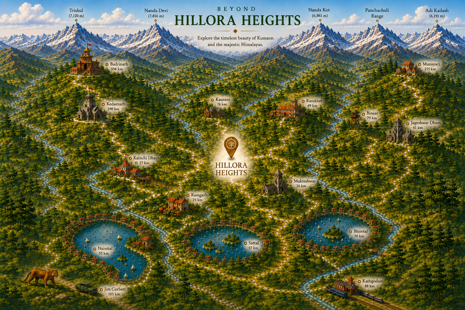
Aeirisa is perfectly located between the region's historic landmarks, pristine lakes, and alpine trekking bases. Hover or tap the markers on the illustrated map below to explore.

Illustrated map of Kumaon showing Aeirisa and nearby destinations, lakes, temples and Himalayan peaks
Every place on the map is interactive — hover, or tap on mobile.
The Region

Your Alpine Launchpad

A comprehensive breakdown of distances and destinations surrounding the Aeirisa estate.

Immediate Circle

  • Dhokaney Waterfall3 km
  • Kakrighat Ashram10 km
  • Ramgarh25 km
  • Mukteshwar26 km
  • Kainchi Dham27 km
  • Almora30 km

The Lake District

  • Pari Taal45 km
  • Bhimtal50 km
  • Nainital55 km
  • Sattal57 km
  • Naukuchiatal60 km
  • Khurpatal65 km

Heritage & Wilderness

  • Ranikhet49 km
  • Jageshwar Dham61 km
  • Kausani76 km
  • Binsar Sanctuary79 km
  • Baijnath Temple99 km
  • Bageshwar100 km
  • Jim Corbett Park103 km
High-Altitude Expeditions:   Munsyari 215 km  |  Darma Valley Circuit ~270 km  |  Adi Kailash & Om Parvat ~300 km

Receive the Estate Brochure

Explore the vision, landscape and estate in greater detail.

Your details remain private.